Even before starting Mergin Maps, Lutra Consulting Ltd. has been very active in the open-source GIS community. I was a QGIS C++ developer a few years before we even started working on the mobile app.
The application uses the C++ rendering engine of QGIS, therefore is all based on the Qt framework. The most challenging part was to port the solution to work on all platforms, most critically Android and also iOS.

Peter Petrik - CPO at Lutra ConsultingThe interviewee, Peter Petrik, is a QGIS core developer and CPO of Mergin Maps. He is a member of UK's GIS consultancy company Lutra Consulting Ltd. fully based around QGIS and Mergin Maps.
https://www.linkedin.com/in/peter-petrik/
I use mostly the applications for my work. To name a few, Gmail or Slack. I love applications that are user friendly and do their job smoothly.

We started development of Mergin Maps in 2017 and open-sourced most of the code in 2021.
Many organizations use pen, paper and camera in combination of online maps and spreadsheets to capture their spatial data. Others have projects in QGIS on desktop, but they missed an easy way to share it and transfer it to smartphones. Mergin Maps is a way to capture and share geo-data with ease.
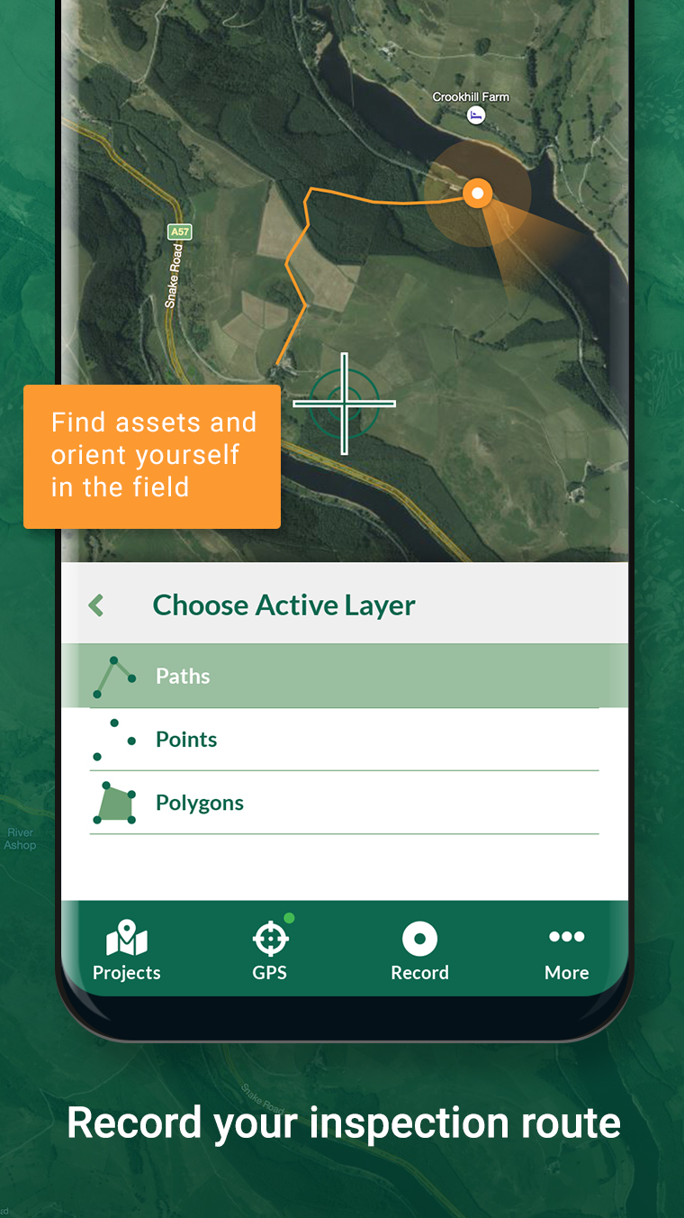
Mergin Maps brings the power of GIS to everyone. You do not need to train your surveyors to use the app and capture data. You can even connect the app to external GNSS devices. On top of that, we have developed a smart way to allow offline collaboration between many people working on the same map. Therefore it is easy to work offline in areas with low connectivity.
We plan to allow a more flexible permission system, so for example you would be able to limit who can access the data only from the app and who can access it from QGIS too. Also we are planning to add features for improved tracking and easy presentation of the produced maps on the web.
Best way to start is to download the app and QGIS and unlock the power of the open-source GIS ecosystem. Also feel free to join our community chat merginmaps.com/community/join to say hello to users and ask more questions.
About App:
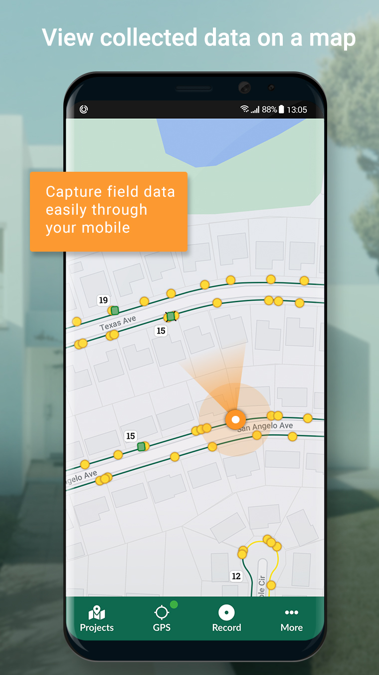
Simplify your field survey by capturing field data on your mobile or tablet. Create mobile forms with the fields you require and invite your survey teams to complete them on their phones or tablets. Captured data, along with their location can be surveyed offline, then synced back to the QGIS in seconds.
Enter your data once, with ease, in the field. Mergin Maps aims to remove the pain of transcribing paper field notes, manually georeferencing photos and transcribing GPS coordinates.
The data you capture in the field survey is shown on a map and can be exported to a wide variety of formats including CSV, Microsoft Excel, ESRI Shapefile, Mapinfo, GeoPackage, PostGIS, AutoCAD DXF, KML and many more.
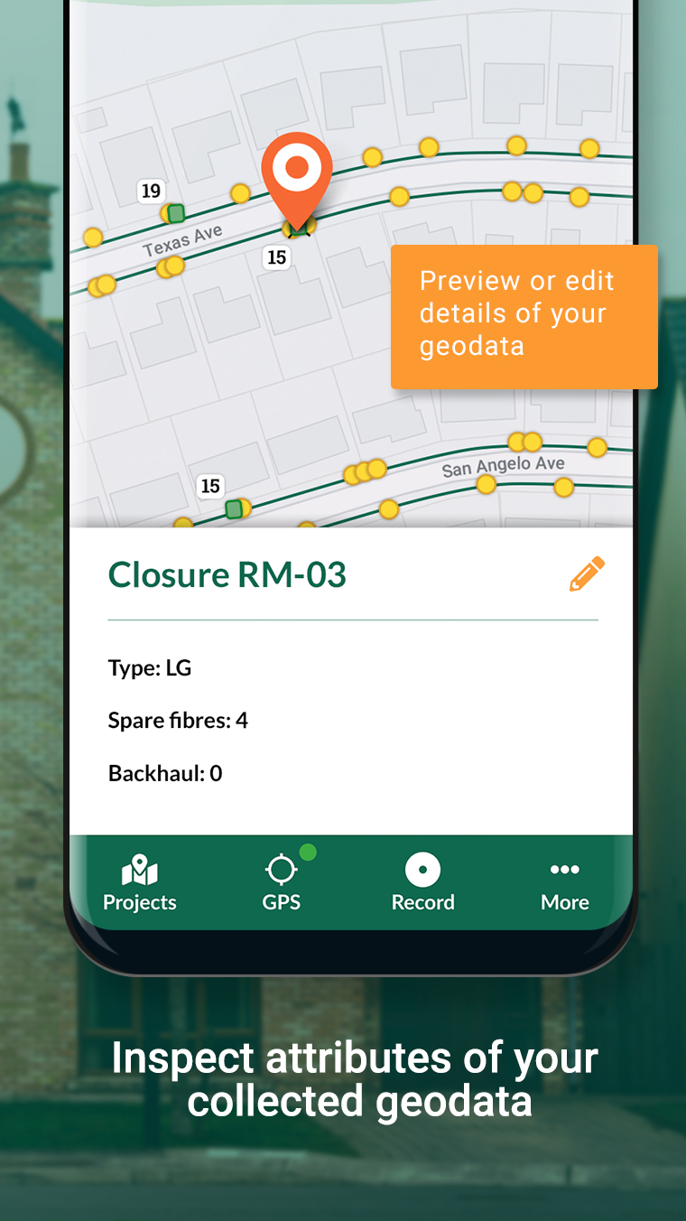
Mergin Maps Input is an extension of the free and open source GIS software QGIS. It allows you to open, interrogate and edit your QGIS projects on your mobile. Map layers look the same as in QGIS desktop and you can sync your data back and forward with QGIS desktop using the Mergin Maps QGIS plugin.
Mergin Maps supports offline field data capture and can be configured to use either offline or web-based background maps and contextual layers.
Perks of the Mergin Maps sync system:
- No need for cables to get your data on/off your device
- Share projects with others for collaborative working
- Safely work together on the same datasets, even offline
- Updates from different surveyors are intelligently merged
- Push data back from the field in real time
- Version history and cloud-based backup
- Fine-grained access control
- Sync with your PostGIS datasets
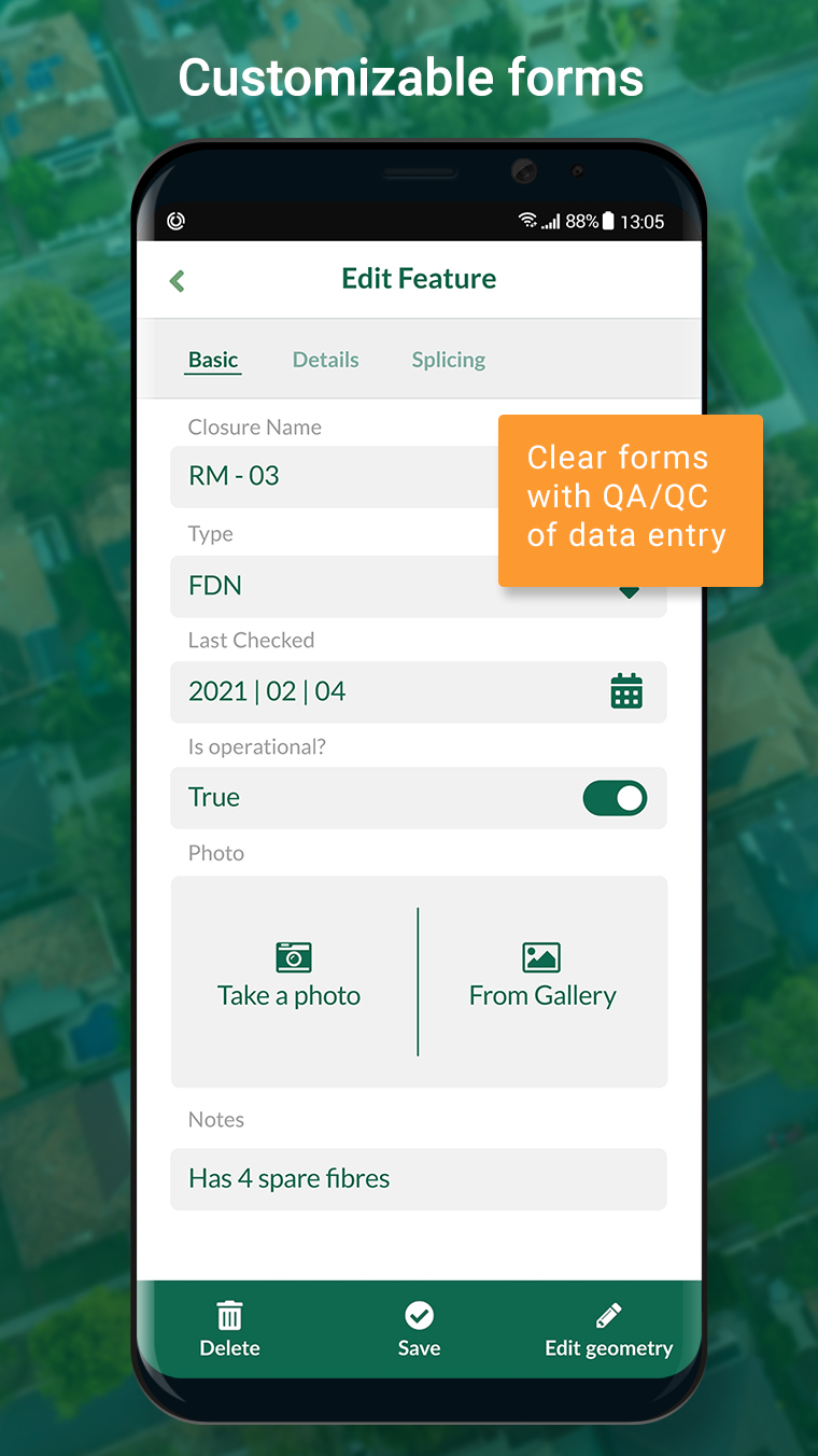
Supported field types for forms are:
- Text (single or multi-line)
- Numeric (plain, with +/- buttons or with slider)
- Date / time (with calendar picker)
- Photo
- Checkbox (yes/no values)
- Drop-down with predefined values
- Drop-down with values from another table
Forms can even be configured to perform data validation using custom rules.
Works with device internal GPS receiver and third-party Bluetooth GPS receivers.
Categories: Productivity
Date: April 20, 2023
Developer: Peter Petrik - CPO at Lutra Consulting
About developer: The interviewee, Peter Petrik, is a QGIS core developer and CPO of Mergin Ma ... Read more
Website: https://merginmaps.com/


Introducing Posh Film, the ultimate movie app for the sophisticated cinephile see ...