In my practical time in college, I got in contact with Macro’s in Microsoft Excel. I thought it was nice because coding in VBA can save you lots of time doing tasks in Microsoft Excel. Later when I started working as a drafter I discovered that you could also do code development in AutoCAD. And since I am lazy, I think most developers are lazy, I continued the development of special functions in AutoCAD for the company I worked for. This saved us a lot of time. And it continued even when we started a civil engineering agency. So from my practical year till now I have continued writing code. This is for about 20 years now. So I have like 20 years of coding experience, even though before starting Apglos it was never my main task.
When we had the civil engineering agency we developed Apglos Survey Wizard, which at that moment was still called different. And it worked well for internal use. The step to take Apglos Survey Wizard to the market was the most complicated because at that moment you will get users that have other wishes and demands than what we built Apglos Survey Wizard for. So people who started to use Apglos Survey Wizard than, would send us their comments. Some were friendly and some were less friendly, but the truth is that every comment or remark that we could solve was improving the app. That was a hard and tough time, especially when at that moment we were not completely focused on Apglos Survey Wizard, yet. We also still had to run a civil engineering agency. Now since we focus only on our software things are getting easier.
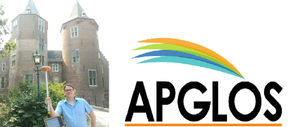
ApglosThe interviewee, Mr. Hanno Kant is the Director of R&D at Apglos, a company that focuses on software development. From the beginning, the company has specialized in GPS software. The main software developed by Apglos is Apglos Survey Wizard.
Besides creating their own software, they also specialize in rebranding their software and creating GPS software based on clients' requirements.
There are some apps that I use a lot. One of them is WhatsApp. It is a great way to communicate. I use it in business but also in private. The great thing about it is that you don’t have to react right away when someone sends you a message.
Another app that is very nice is GPS Satellites Viewer. It is a bit related to Apglos Survey Wizard. With Apglos Survey Wizard you can map and stake out based on GPS. And with GPS Satellites Viewer you can see in Augmented Reality where the navigation satellites are. That means you can see with that app if satellites are behind buildings or trees. Then the satellite signals get blocked and you won’t be able to use them.
The last app I will name here is called Chess. It is the app of Chess.com. You can play chess against everyone in the world, from home. That I do for relaxing sometimes or when I have to wait. Then you can play quickly a game of chess.

When we finished tidying up the archive of the civil engineering agency we found documents about the development of the app in 2012. Then it was just for our own use. In 2017 we started our company Apglos. Still, then we were busy finishing up our civil engineering agency. So in 2019, we could finally focus on the development of Apglos Survey Wizard. Most of the development was done in the first two years. So in 2019 and 2020. After that is mainly maintaining. We made iOS a priority in 2022. So we developed the iOS version of Apglos Survey Wizard in 2022 and 2023. In the meanwhile, we had some other projects that kept us busy.
Actually, we were our first users of the app. We had this civil engineering agency. And in this civil engineering agency, we got more and more land surveying projects. First, we were always hiring land surveyors. But that is costly and it is hard to schedule. So then we were wondering: Can we land survey ourselves? So we invited dealers of GPS land survey equipment to give a demonstration of their GPS surveying kits. So we watched 3 or 4 demonstrations and all GPS land surveying software was so complicated. There is no need for the user to know all about geoids and ellipsoids. Our users want to get a position and save that position in some way. So then we decided we have to create it ourselves. We need GPS surveying software that is easy to use, even if you are not using it every week.
And then we started to develop Apglos Survey Wizard. It still has and always will have this focus. For example, we have an integrated walkthrough built-in Apglos Survey Wizard. That means you can tell the app what you want to do and the app guides you through every step.
To be able to give an answer you have to understand that there are two different kinds of land surveying apps. The first kind is the group of apps that just focus on a small specific task in land surveying, like for example Fields Area Measure. The other group of apps is a group of apps that has many land surveying functionality, like mapping, staking out, calculation in the field, saving to GIS formats, saving to CAD formats, etc.
Apglos Survey Wizard belongs to the second group of apps. It is very complete compared to the first group of land surveying apps. Apglos Survey Wizard is also special in the second group of apps with full land surveying functionality.
Since Apglos Survey Wizard is in the market and we launched it as easy-to-use land survey software, other software also started to market their software as easy-to-use. But if you dive in deeper you will see a difference. All apps in the group of full land surveying apps are developed with a land surveyor as a user in mind. Apglos Survey Wizard is the only full land surveying app that is for people who want to land survey.
There is a big difference in that. Apglos Survey Wizard makes it possible for everyone to use all functionality to land survey, without you needing a course or study.
Another difference is that Apglos Survey Wizard is the only surveying app with full functionality for iOS. Which is of course a main difference.
As you might know, the development of an app is never finished. The world does not stand still. And there are always new developments. We listen to the needs of our users. From within Apglos Survey Wizard, there is a possibility to ask a question to us, the developers. More direct is impossible. But besides the needs of our users, we have plans to connect more supporting devices.
Of course when you want to land survey with centimeter accuracy then you need a GNSS receiver. There are standard protocols for communication. But lately, we have focused on combining the position of the GNSS receiver with other supporting devices. With for example an echosounder, you can measure the depth. In combination with the position, you can measure the level of the bottom of a lake or a river. This year we could connect our software with a cable detector. So then you measure the level and the position of cables without digging. So we would like to connect Apglos Survey Wizard with more supporting devices, like for example a range finder. Or to get a version where you can also use the app inside with a total station instead of a GNSS receiver.
There are some things that I want to ask new users. First of all, check our tutorial on Youtube (https://www.youtube.com/watch?v=OkUo09PsuDc). After logging in to Apglos Survey Wizard, you will be asked if you want to see this tutorial. If you answer with Yes then you will see this tutorial, where we explain what you can do with Apglos Survey Wizard and how to do it.
Another thing that I want to tell new users is that the device they are using is responsible for the accuracy of the position. The accuracy of a phone/ tablet in the open field is between 2 and 5 meters. If you need better accuracy, then you can still use Apglos Survey Wizard, but you need a GNSS receiver. We also explain that on our Youtube channel.
About App:
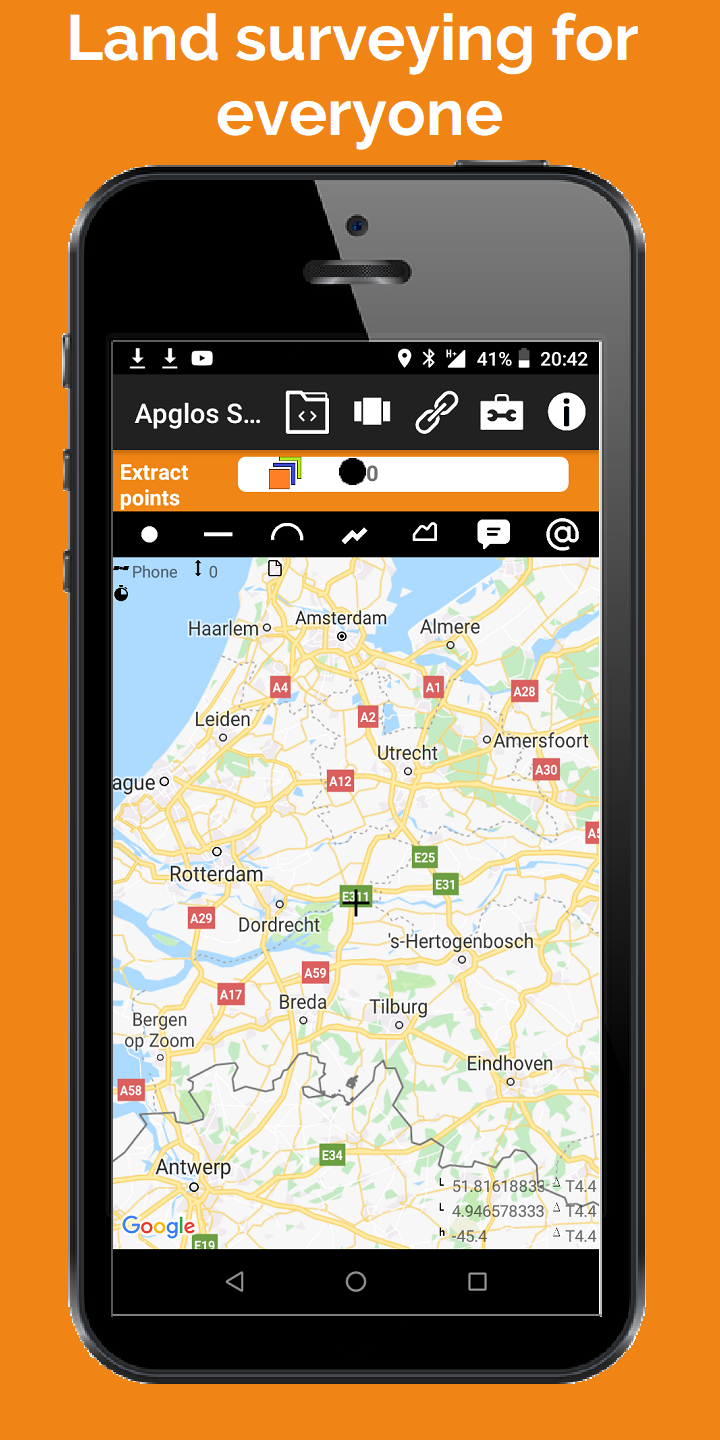
Apglos Survey Wizard is the No. 1 land survey app. It is EASY to use. It has MANY FEATURES, like mapping, staking out, drawing and calculation.
This app has many already integrated coordinate reference systems. It is very SIMPLE, but the results are GREAT. Start right NOW.
Apglos Survey Wizard can be connected to a GNSS receiver. In this way land surveying can be done with cm accuracy. This field data collection app works with almost any GNSS antenna.
It has been tested with the following GNSS receivers:
-Topcon Hiper VR
-Emlid Reach RS2
-Bad Elf Flex
-Trimble R8s
-Tersus GNSS David
-Tersus GNSS Oscar
-Septentrio Altus NR3
-Septentrio Altus NR2
-Sokkia GCX3
-Spectra Geospatial SP60
-Spectra Geospatial SP80
-Spectra Geospatial SP85
-KQgeo M8L
-Marxact UNI-GR1
-and many more
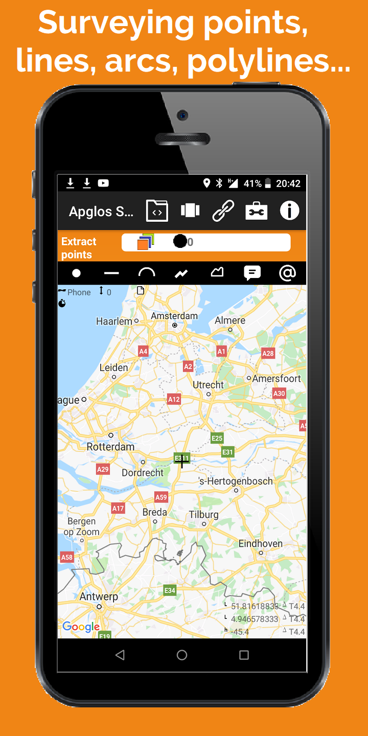
This land survey app is great for exporting points from the field or for field data collection. This app makes you able to land survey points, lines, arcs, polylines and areas. Besides that you can add comments and symbols to the drawing. It is ideal for land surveying of civil engineering works, mining or construction.
Apglos Survey Wizard uses layers like AutoCAD. All layes have colors, line styles and line weights. You can change them in the same way as in AutoCAD.
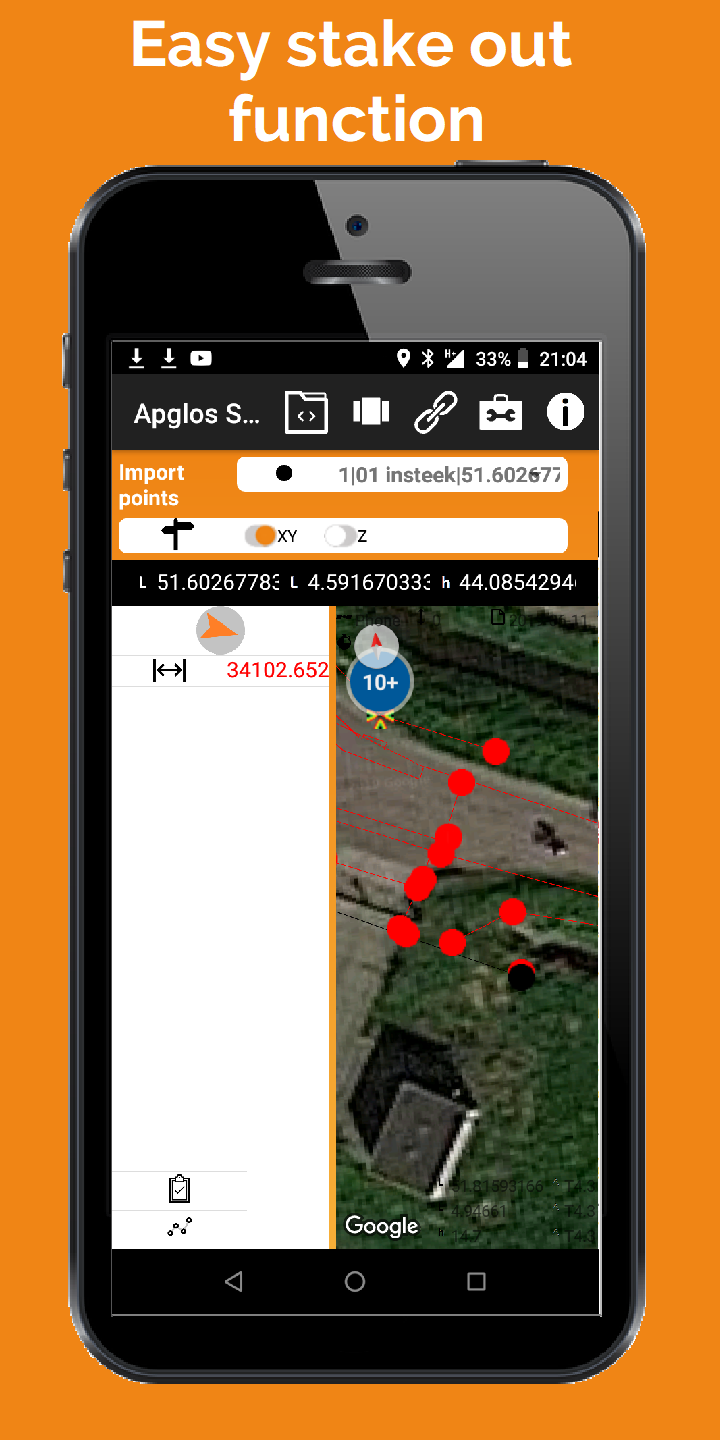
Also staking out or importing points into the field is included in this land survey app. Select a point on the Google map and you will see the direction and the distance to this point right away. You don't have to worry about how you hold the device where this GPS app is installed on. Apglos Survey Wizard keeps notice of this and changes the given direction. You only have to follow the arrow.
Small drafting work can also be done in this land survey app for GPS. Elements can be offsetted, extended or shortened. But also points can be added manually by filling the coordinates. Points can be connected. In this way lines, arcs, polylines and areas can be drawn. It is very easy.
Another great function is the calculation method. With Apglos Survey Wizard you can calculate areas, lengths and distances. Also height difference and element count are very popular functions.
This land survey app can also be used as a GIS app. It has full GIS functionality. Elements can be added and deleted. Also attributes can be added and changed. Also photos can be made of elements. For using the GIS functionality you don't need a GNSS receiver. Then this app works on the GPS of the device, like a telephone or a tablet.
A GNSS receiver is only necessary when you want to land survey with cm accuracy. Apglos Survey Wizard has some security built in that no values can be surveyed when there is no RTK correction. Non accurate values won't be collected. It will give you a warning. Also a warning is given when you want to stake out points. The distance will be marked red. Then you know that the distance given is not that accurate.
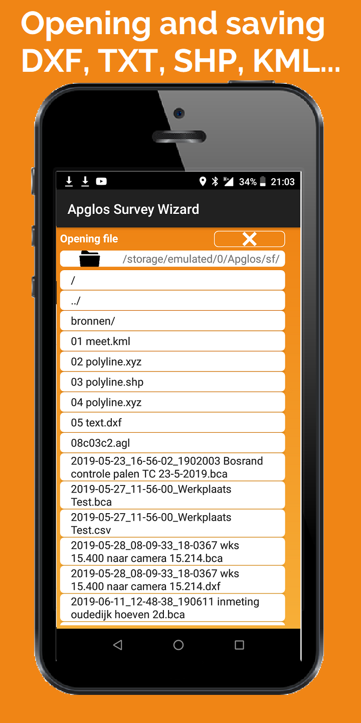
As you can see this is a very complete land survey app for GPS. Apglos Survey Wizard can open en save data in the following formats:
-dxf
-txt
-csv
-kml
-agl
-agp
-shp
-xyz
It can also save data in landxml file format.
This app can do a lot, but the main thing is that it is very easy to use. Anyone can use this land survey app.
Categories: Tools
Date: March 27, 2023
Developer: Apglos
About developer: The interviewee, Mr. Hanno Kant is the Director of R&D at Apglos, a c ... Read more
Website: http://apglos.eu/