GPS Waypoints was our first APP. We developed it as we need to make surveys of golf courses but we could not find a suitable APP available.
Initially, the main challenge was supporting thousands of Android devices. Now, the main difficulties are to support the continuous changes of user's security policies and the increasing mobile development restrictions.

BluecoverTechnologiesNuno Duro, the interviewee, is the founder of BLUECOVER Technologies, responsible for GPS Waypoints product management. Nuno is a software engineer, actively working in Space downstream services for the last 12 years, both on Navigation and Earth Observation.
We love our apps of land surveying, golfing, and mobility.
It was initially published in 2015 but continuously evolving with new features.
Our initial objective was enabling regular smartphones’ users of Android devices to become surveyors and map creators. It later evolved to professionals from various sectors (agriculture, forest, utilities…) that require better accuracies and GIS data management functions.
Our entry-level advantage is being simple and very mature. The benefits for advanced users are the data acquisition with quality metadata (source, quality fix, estimated accuracy, and signal quality), integration with external high precision receivers, exports, and imports with interoperability with other tools.
Integrate high precision data acquisition, using RTK technology for achieving centimeter-level accuracies, as well as provide advanced data management functions.
Test our app and provide us feedback with your suggestions.
About App:
Multi-purpose mapping and surveying tool for both professional and personal use. The tool is valuable in several professional land-based surveying activities, including agriculture, forest management, infrastructure maintenance (e.g. roads and electrical networks), urban planning & real estate, and emergency mapping. It is also used for personal outdoor activities, such as hiking, running, walking, traveling, and geocaching.
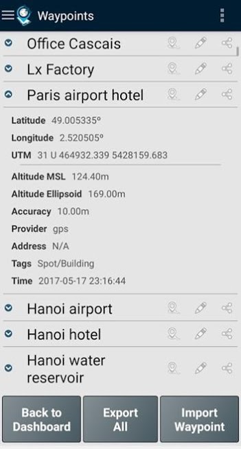
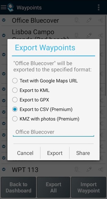
The application collects Points (such as points of interest) and Paths (sequence of points) to perform mapping and surveying activities. The Points, that are acquired with accurate information, can be classified by the user with specific tags or characterized with photos. The Paths are created as a temporal sequence of newly acquired Points (e.g. to record a track) or alternatively with existing Points (e.g to create a route). Paths allow to measure distances and, if closed, forms Polygons that allow the determination of areas and perimeters. Both Points and Paths can be exported to a KML, GPX, and CSV file and thus be processed externally with a geospatial tool.
The application uses the internal GPS receiver from the mobile device (typically with accuracies >3m) or, alternatively, allows professional users to attain better accuracies with a Bluetooth external GNSS receiver compatible with NMEA stream format (e.g. RTK receivers with centimeter-level precision). See below for some examples of the external receivers supported.
The application includes the following features:
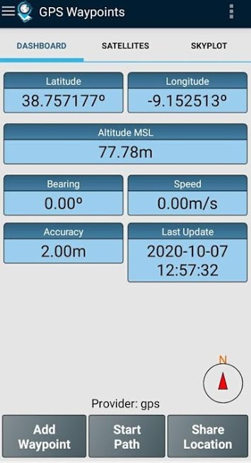
- Acquire current position with accuracy and navigation information;
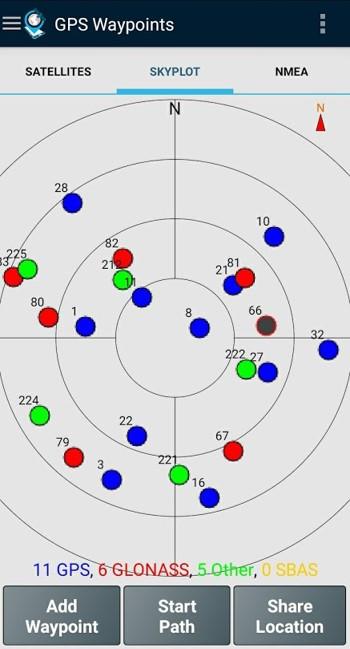
- Provide details of the active and visible satellites (GPS, GLONASS, GALILEO, BEIDOU, and other);
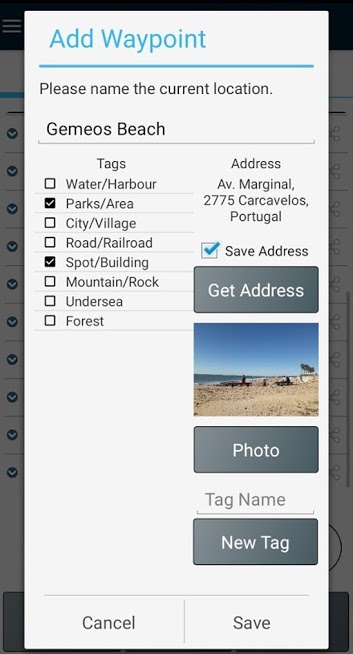
- Create Points with accuracy information, classify them with Tags, attach photos and convert coordinates into a human-readable address (reverse geocoding);
- Create survey's themes with custom Tags for classifying Points and Paths
- Get directions and distances from the current position to Points and Paths using a magnetic or GPS compass;
- Share data with other applications (e.g. Dropbox/Google Drive);
- Configure positioning source for the internal receiver or using an external receiver.
If you successfully tested the application with another external receiver please provide us your feedback as a user or manufacturer in order to extend this list.
Categories: Tools
Date: June 2, 2021
Developer: BluecoverTechnologies
About developer: Nuno Duro, the interviewee, is the founder of BLUECOVER Technologies, respo ... Read more
Website: http://www.bluecover.pt/